Agricultural land Nicolosi
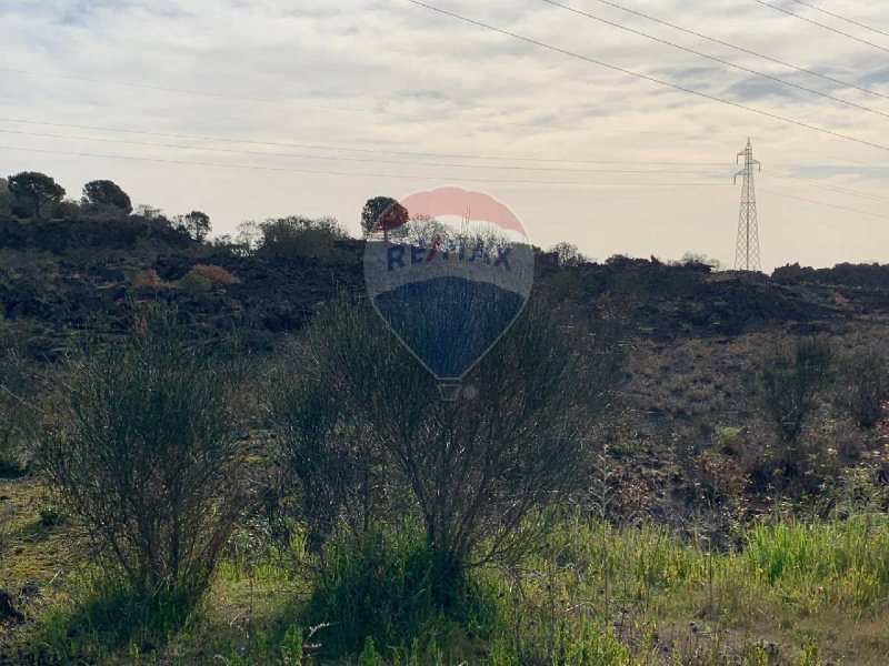
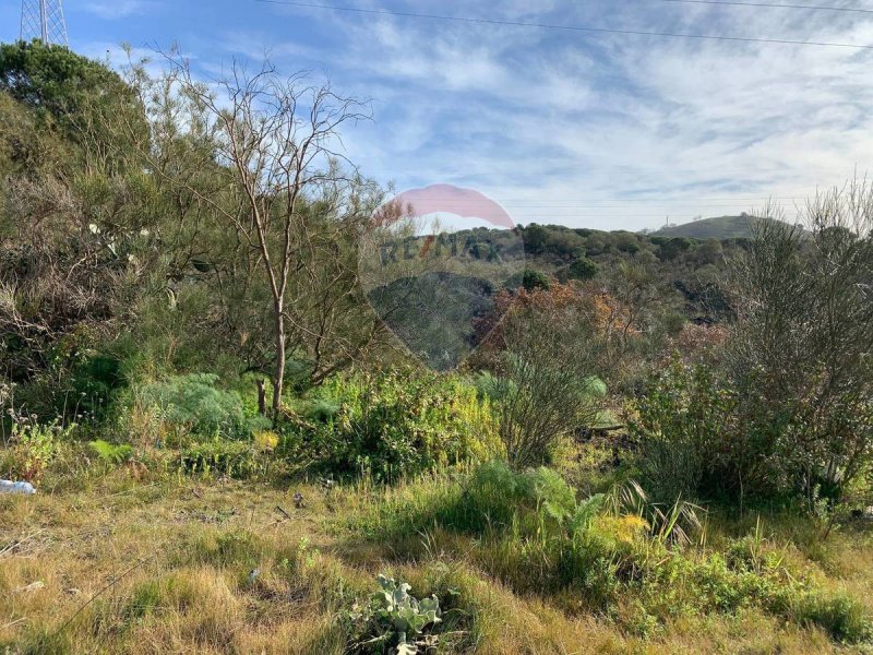
Agricultural land of 17960 m2 partly flat and partly steep.
The land is located in the Scalonazzo district in the E3 area and consists of two joined and unfenced lots. It is accessed from a public asphalt road and then continues along a dirt path.
The current owner has requested, pursuant to art. 18, paragraph 2, of law no. 47 of 28.02.85, the release of the relevant Certificate of Urban Planning Destination for Hospitality/Tourism use.
The water network coming from Bronte is 150 meters from the land and the electricity network is 300 meters away.
Its surface falls within the area where, according to the current General Regulatory Plan, there will be a recovery of spontaneous building. (Land falling within the PP area with protection level 1 of the Regulatory Plan, context 18/b.
The first lot in the E3 zone is 66% agricultural, 7% area for new roads connecting existing roads, 25% buffer zone, i.e. distance imposed for road safety.
The second lot in E3 zone 100%
ref.1318-104
Idioma a partir do qual a tradução automática foi gerada
Terreno agricolo Nicolosi
Terreno agricolo di 17960 mq in parte pianeggiante ed in altre sciaroso.
Il terreno trova in contrada Scalonazzo in zona E3 costituito da due lotti uniti e non recintati, si accede da strada pubblica asfaltata, per poi continuare in un sentiero sterrato.
L'attuale proprietario ha richiesto ai sensi dell'art.18, comma 2, della legge n 47 del 28.02.85, il rilascio del relativo Certificato di Destinazione urbanistica ad uso Ricettivo/Turistico.
A 150 mt dal terreno è presente la rete idrica che proviene da Bronte ed a 300 mt quella elettrica.
La sua superficie ricade nella zona dove, secondo il vigente Piano Regolatore Generale, ci sarà un recupero dell'edilizia spontanea. (Terreno ricadente all'interno dell'area P.P. con livello di tutela 1 del Piano regolatore, contesto 18/b.
Il primo lotto in zona E3 66% agricolo, 7% area per nuova viabilità di collegamento sede stradale di tracciati già esistenti, 25% fascia di rispetto cioè distanza imposta per la sicurezza stradale.
Il secondo lotto in zona E3 100%
rif.1318-104
Nicolosi-Agrarland
Ackerland von 17960 m2, teilweise flach und teilweise flach.
Das Grundstück befindet sich im Ortsteil Scalonazzo im E3-Gebiet und besteht aus zwei verbundenen und nicht eingezäunten Grundstücken, die über eine öffentliche Asphaltstraße und dann über einen unbefestigten Weg zugänglich sind.
Der jetzige Eigentümer hat gemäß Art. 18, Absatz 2 des Gesetzes Nr. 47 vom 28.02.85 die Herausgabe der entsprechenden Bescheinigung über die Beherbergungs-/Touristennutzung beantragt.
In 150 Metern Höhe über dem Boden befindet sich das Wassernetz aus Bronte und in 300 Metern Höhe das Stromnetz.
Seine Fläche liegt in dem Bereich, in dem es laut dem aktuellen Generalplan der Stadt zu einer Erholung der spontanen Bebauung kommen wird. (Grundstücke, die zum PP-Gebiet der Schutzstufe 1 des Masterplans gehören, Kontext 18/b.
Das erste Grundstück im E3-Gebiet besteht zu 66 % aus landwirtschaftlichen Flächen, zu 7 % aus Fläche für neue Straßen, die die Straße mit bestehenden Strecken verbinden, und zu 25 % aus einer Pufferzone, d. h. aus Gründen der Verkehrssicherheit vorgeschriebene Entfernung.
Das zweite Los in der E3-Zone 100 %
Ref. 1318-104
Terrain agricole de Nicolosi
Terrain agricole de 17960 m2 en partie plat et en partie plat.
Le terrain est situé dans le quartier de Scalonazzo dans la zone E3, composé de deux lots mitoyens et non clôturés, accessibles depuis une voie publique asphaltée, puis se poursuit par un chemin de terre.
Le propriétaire actuel a demandé, conformément à l'article 18, paragraphe 2, de la loi n. 47 du 28.02.85, la délivrance du Certificat de Destination Urbaine à usage Hôtelier/Touristique correspondant.
A 150 mètres du sol se trouve le réseau d'eau qui vient de Bronte et à 300 mètres celui d'électricité.
Sa superficie se situe dans la zone où, selon le Plan Général de la Ville en vigueur, il y aura une reprise de la construction spontanée. (Terrain relevant de la zone PP de niveau de protection 1 du Schéma Directeur, contexte 18/b.
Le premier lot de la zone E3 66% agricole, 7% zone pour les nouvelles routes reliant la route aux itinéraires existants, 25% zone tampon soit distance imposée pour la sécurité routière.
Le deuxième lot en zone E3 100%
réf.1318-104
Николоси сельскохозяйственная земля
Земля сельскохозяйственного назначения площадью 17960 м2 частично ровная и частично ровная.
Земельный участок расположен в районе Скалонаццо в зоне E3 и состоит из двух соединенных и не огороженных участков, доступ к которым осуществляется по асфальтированной дороге общего пользования, а затем продолжается по грунтовой дороге.
Нынешний владелец запросил в соответствии с пунктом 2 статьи 18 закона № 47 от 28.02.85 г. выдачу соответствующего Сертификата городского назначения для гостиничного/туристического использования.
В 150 метрах от земли находится водопроводная сеть Бронте, а в 300 метрах - электрическая.
Площадь его территории приходится на территорию, где согласно действующему Генеральному плану города будет осуществляться восстановление стихийной застройки. (Земля, попадающая в зону ПП с уровнем защиты 1 Генерального плана, контекст 18/b.
Первый участок в зоне E3: 66% сельскохозяйственной территории, 7% территории для новых дорог, соединяющих дорогу с существующими маршрутами, 25% буферной зоны, т.е. расстояния, установленного для безопасности дорожного движения.
Второй лот в зоне Е3 100%
арт.1318-104
Tierras agrícolas Nicolosi
Terreno agrícola de 17960 m2 en parte llano y en parte llano.
El terreno está ubicado en el distrito de Scalonazzo en la zona E3, compuesto por dos lotes unidos y sin vallar, a los que se accede desde un camino público asfaltado y luego continúa por un camino de tierra.
El actual propietario ha solicitado, de conformidad con el art. 18, párrafo 2, de la ley n. 47 del 28.02.85, la liberación del correspondiente Certificado de Destino Urbano para uso hotelero/turístico.
A 150 metros del suelo se encuentra la red de agua que viene de Bronte y a 300 metros la de electricidad.
Su superficie se sitúa en la zona donde, según el actual Plan General Urbanístico, se producirá una recuperación de la edificación espontánea. (Terrenos comprendidos dentro del área del PP con nivel de protección 1 del Plan Maestro, contexto 18/b.
El primer lote en el área E3 es 66% agrícola, 7% área para nuevas carreteras que conectan la carretera con rutas existentes, 25% zona de amortiguamiento, es decir, distancia impuesta por seguridad vial.
El segundo lote en la zona E3 100%.
ref.1318-104


